

Discover more from The Journal 425
Snow, Frigid Temps on the Way for the 425
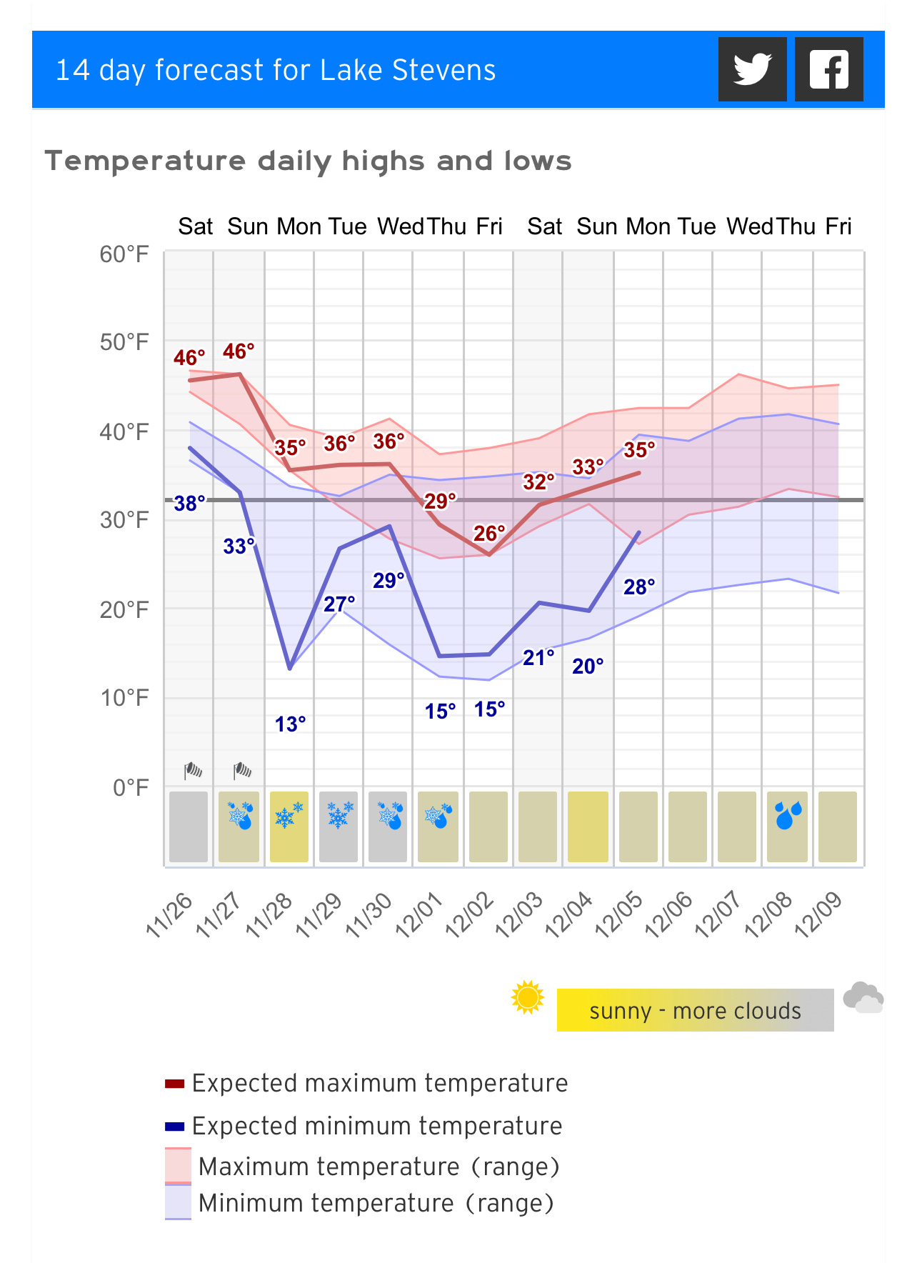
Cooldown Sunday with lowland snow probable Wednesday followed by record lows
The bottom line: you can be confident about lots of mountain snow and a major cold period next week. There is a significant chance of lowland snow in western Washington but substantial uncertainty at this time. By Monday we should have a very good idea of what will happen. - Cliff Mass Weather
The National Weather Service and the more accurate European forecasting conglomerate are in agreement that the lowland PNW is hours away from the start of a classic La Niña winter event complete with winds, lowland snow and pipe-shattering lows.
The initial cooldown begins Sunday into Monday with snow levels lowering towards the floor before clearing and chilly lows in the 20s Monday and Tuesday.
Wednesday has a front rotating in from the Gulf of Alaska bringing with it lowland snow through the day Wednesday followed by lows in the teens to single digits Thursday and Friday.
More snow is predicted during the 4A State Championship game next Saturday, but that’s a bit out of the precision zone with regard to forecasting.
Back to Wednesday — can we really be sure of snow thus far out? Of course not, but given the model agreement forecasters are above 80% certainty.
Here’s a 24 hour snowfall prediction generated by hundreds of model runs.
Basically the entire lowlands are covered with 2”-5” inches.
For now, maybe concentrate on the coming cold because that sort of the forecast is a surety. It’s time to secure those pipes, insulate your bulbs and perennials with some mulch or hay and make plans for your outdoor critters.
With regard to the rest of it, we’ll defer to Cliff Mass for the bottom line.
The bottom line: you can be confident about lots of mountain snow and a major cold period next week. There is a significant chance of lowland snow in western Washington but substantial uncertainty at this time. By Monday we should have a very good idea of what will happen.