

Breaking: Maps Show the Catastrophic Flooding Forecast for Snohomish River and Tributaries
Snohomish River crept above flood state this morning, expected to crest above the all time record by Friday

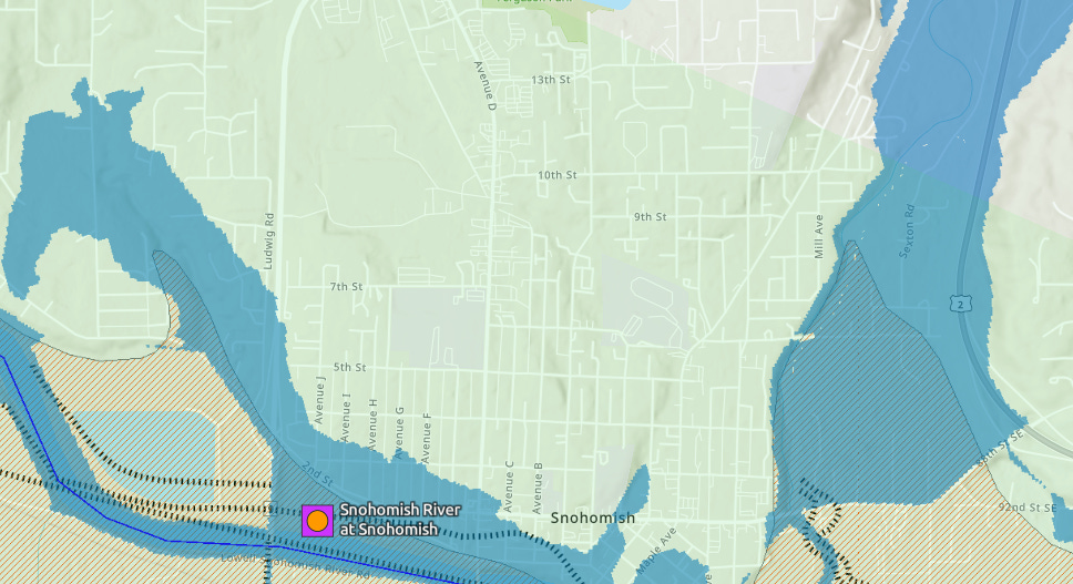
SNOHOMISH — The Snohomish River at Snohomish crept above flood stage an hour ago in downtown Snohomish.
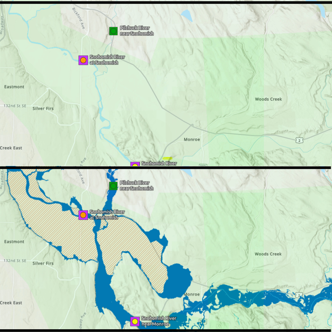
And the National Weather Service says the Snohomish is forecast to rise another eight-plus feet before cresting at or above the all-time record sometime Friday, with major urban flooding of downtown Snohomish ensuing, as well as moderate to major flooding of the Pilchuck River through the Machias valley area.
The Stillaguamish River at Granite Falls is forecast to undergo moderate flooding beginning today.
This is a developing story.
Record Flooding Headed for Snohomish River Valley
WHAT...Minor flooding is occurring and major flooding is forecast. This approaches the flood of record. J425 has experimental Flood Innundation Maps that predict where the rising flood waters will go after they top banks and levies.
WHERE...Snohomish River at Snohomish…Stillaguamish River at Granite Falls…and tributaries including the Pilchuck River along Machias…
WHEN...Until late Saturday evening.
IMPACTS...At 33.0 feet, the Snohomish River will cause severe near record flooding. Flood waters will likely overtop levees...with major levee damage possible. Flood waters will inundate much of the river valley...including SR2 west of Monroe...SR9 and the Lowell-Snohomish River Rd. Flooding will occur all along the river including headwaters...tributaries...and other streams within and near the Snohomish River Basin. A stage of 33 feet on the Snohomish River corresponds to a Phase 4 in the Snohomish County flood program.
ADDITIONAL DETAILS...
Flooding is underway. At 10:00 AM today,
